Swampy and remote. Bogs and peatlands are often difficult to access. But they’re also of great importance. Peatlands are host to numerous species, and they retain large amounts of CO2 – preventing its escape into the atmosphere. There are plenty of reasons to preserve and study them. How deep are they, and what is their composition? From different perspectives, there is a demand to know more.

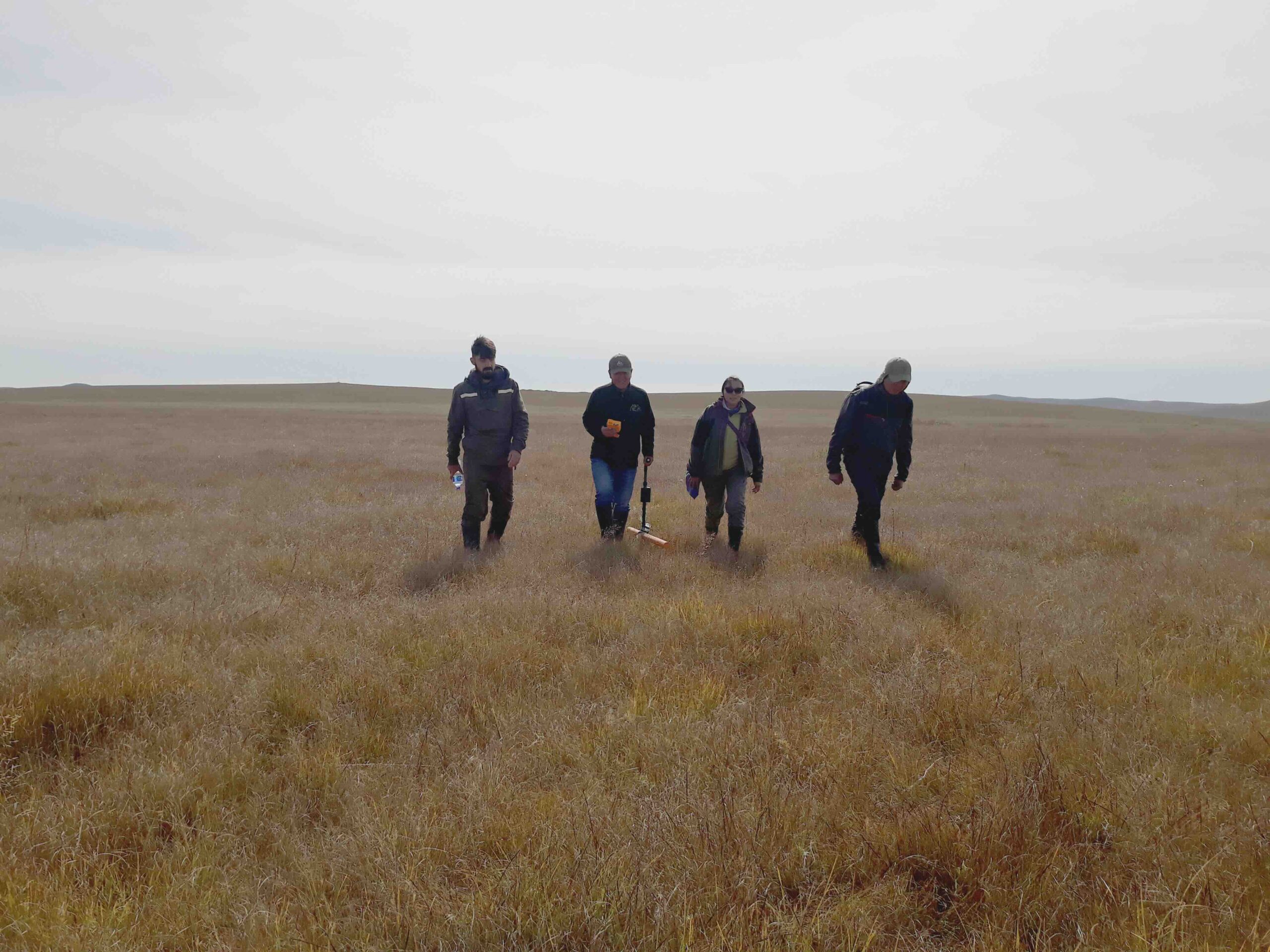
This also goes for the construction of a windfarm in Ireland. During the preliminary stages, significant effort is devoted to mapping peat thickness. Since building on peat soil is very complex due to stability issues, accurate knowledge of the subsurface is crucial. The thickness of peat layers can vary greatly, and thicker layers are preferably avoided. Therefore, months of intensive manual effort go into collecting numerous point measurements to provide the required insights. Could this be done differently? Faster, or with less risk of collateral damage? From the air, perhaps?
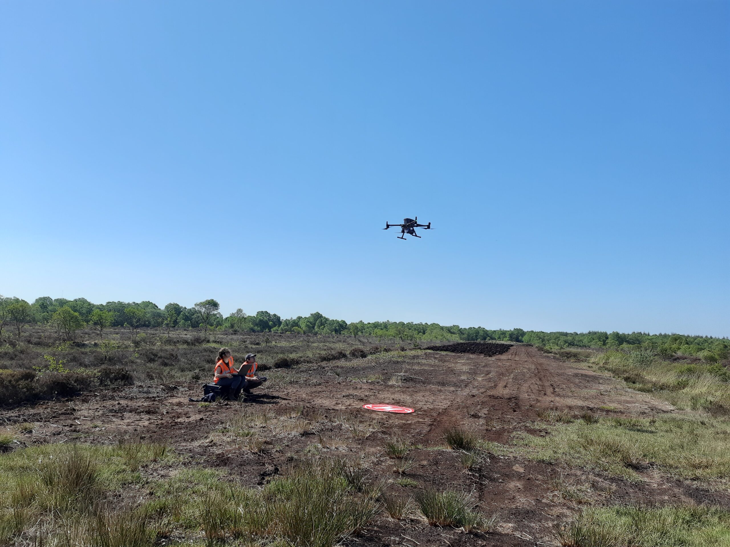
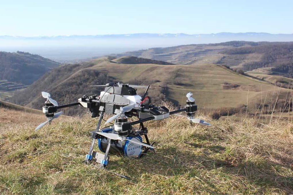
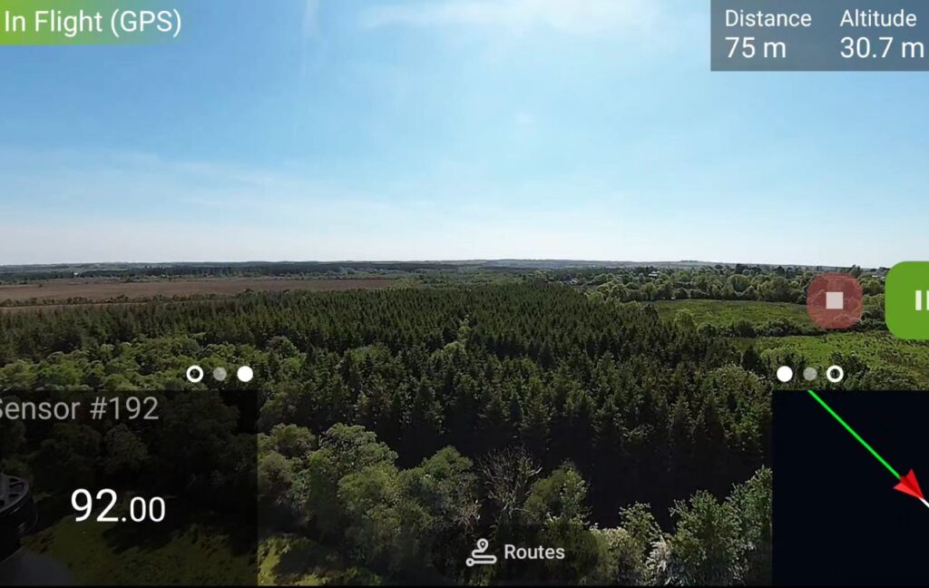
Our experience indicates we can. Invited by Whiteford Geoservices, we set out to demonstrate this. We mounted one of our sensors—the MS-350 gamma spectrometer developed by colleagues from Medusa Radiometrics—under a large drone. With this setup, we surveyed several areas designated for infrastructure such as foundations and access roads. From a safe altitude, preplanned measurement lines were automatically surveyed. Marshy sections, uneven terrain, and dense, nearly impenetrable forests were effortlessly navigated. While the work was monitored remotely from a more accessible location nearby via the onboard camera.
As usual in our work, to map our survey area, we made use of naturally occurring radioactivity.
The very low concentrations of radiating substances in the subsurface can be measured and used to distuinguish between soil types. However in this particular case, we used the radiation from the bedrock beneath the peat layers. Since we are focussed on the thickness of peat layers rather than the composition of the peat itself, we made use of its absorbing characteristics to estimate layer thickness. Simply put: the more peat there is, the less we measure.
Since traditional borehole drilling had already been carried out in this area, we were able to compare our aerial data with existing ground-based measurements. If the results align closely enough, this aerial method could contribute to optimized planning at early stages of peatland projects.
Preliminary results are promising: a clear correlation between arial data end the manually obtained peat-thickness map is shown in the below comparison.
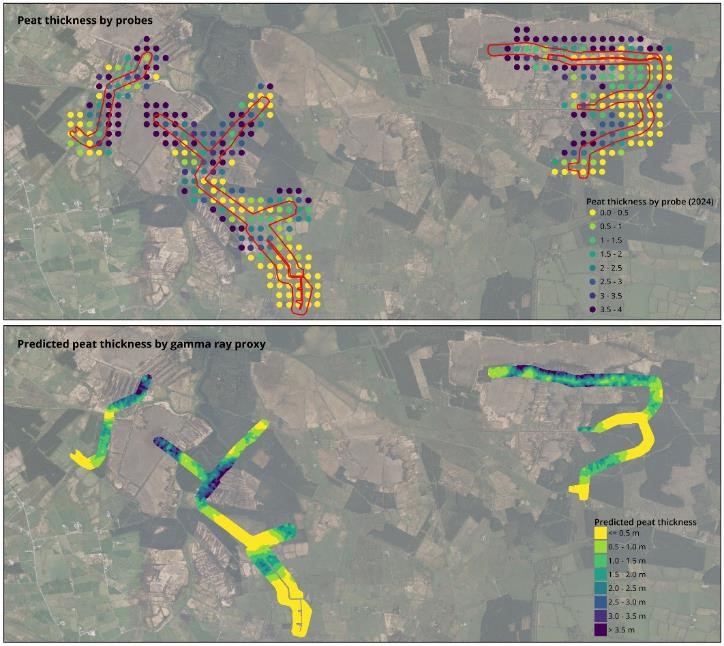
Eventhough we were able to produce the same overall information about the area, it took us only a few days. Definitely an improvement over the many hours of hard labour that went into making the traditional map! Applied in the early stages of a project, planning can be adjusted to save work later. Collateral damage to the delicate lands or personnel carrying out the traditional drilling is avoided, saving trouble and time.
- Consultancy
- Mapping
- Blog
- About us
- Contact