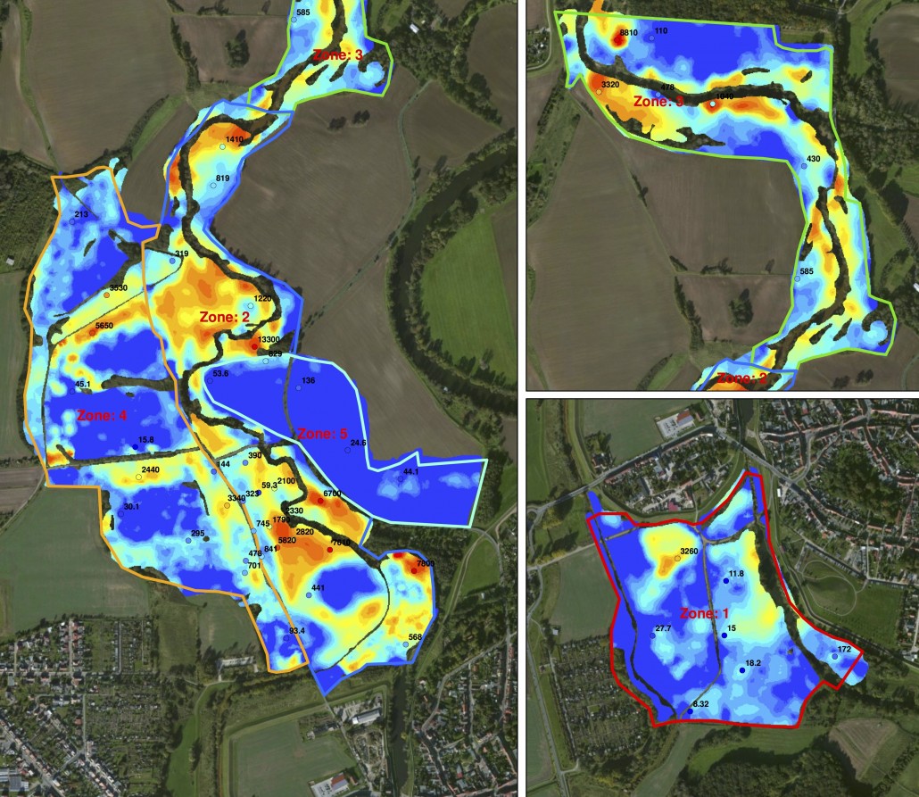


For decades, wastewater from the chemical industry at the Bitterfeld-Wolfen industrial megapark was discharged into the Spittelwassercreek without treatment. Medusa Exploration mapped the contamination in the sediments of a floodplain in high detail. The results of these measurements are now being used to draw up a plan for the remediation of contaminated hotspots.

Several organic chemicals released from the area via the Spittelwasser, namely polychlorinated dibenzodioxins and furans (PCDD/F), hexachlorocyclohexane (HCH) and organotin compounds, are among the most important parameters affecting the quality of the Elbe’s surface waters. Under the EU Water Framework Directive (WFD) and national legislation, actions to improve water quality have been specified, focusing on management objectives.
Reduction targets have been defined for the historic industry in Bitterfeld-Wolfen, making this area a primary focus for future corrective measures. However, knowledge of the system and related processes was insufficient to identify suitable locations or determine the extent of possible measures. In 2010, Tauw was contracted by the Landesanstalt für Altlastenfreistellung (LAF) to design and conduct a study.
The study aimed to provide detailed insight into the current state of the system, giving authorities a solid basis for future corrective action decisions. Over a year, an extensive research program was conducted. Water and suspended sediments were sampled and analyzed for relevant organic parameters at each river section. Additionally, the amount and quality of sediment in the Spittelwasser creek and the Mulde were investigated, and the contamination in the Spittelwasser floodplain was mapped in collaboration with Medusa.
The results provided a completely new picture of the status and development of surface water contamination in the Spittelwasser and its role in the Elbe watershed. Corrective measures, such as dredging sediments in the Spittelwasser creek, which were strongly demanded in political discussions, were found to be ineffective, while other areas were identified as potential targets for future actions.
Read the original post here, in Tauw Soil’s newsletter.