

Get started: stream restoration of 40 km of streams in the Drentsche Aa area. A beautiful but complex area, with lots of opportunities, demands and stakeholders. Due to increasingly frequent dry periods, water is sinking below ground level, leading to weakening and drying out of special plants and vegetations. The combination of drought and excess nitrogen is not a good combination for the special moisture-loving and sparse plants found here. Therefore, plans have been made for stream restoration.

The Drentsche Aa area must comply with the Programme Approach to Nitrogen (Programma Aanpak Stikstof, PAS), which aims to reduce the effects of nitrogen deposition. This is because this deposition poses a threat to heathland grasslands, blue grasslands and quaking fen, which are legally protected under Natura 2000 rules. In addition, the stream must comply with the Water Framework Directive (WFD), a European treaty that focuses on water quality. The Netherlands must show significant improvements over the next five years to meet these requirements.
There are several ways to get more water into the stream. For example, by simply making the stream deeper. However, this has the effect of quickly draining water away from the area. However, this results in water quickly running off from the area. Raising the stream, on the other hand, creates free flowing, relatively shallow, meandering and varied watercourse. This not only benefits the water quality but can also lead to flooding in the surrounding area – flooding with water from the stream, which has a relatively high nutrient content. This in turn poses a risk to protected species such as sparse plant species like quaking bogs.
Choosing a measure is not only challenging, but there are multiple interests at play in the area. The area harbours a lot of archaeology and cultural-historical values. This, in turn, attracts a lot of visitors. And the surrounding area also has agricultural and residential functions.
There has been much discussion over the past few years, including by Peter Paul Schollema of Hunze and Aas water board, one of the people who has been heavily involved in this issue. He has concluded that raising the creek bed best meets all the requirements. This results in higher water levels, especially during dry periods when the risk of desiccation is highest, without substantially changing the desired flow conditions for ecological water quality in the brook. This falls under the project ‘Monitoring brook bed elevation Drentsche Aa’.
These are small streams in an area that is not easily accessible to trucks full of sand, even if that would be desirable. A new approach is therefore being tested in three streams: a long tube is used to pump sand and water directly into the stream as it meanders through the landscape. In addition, woody material is placed in the stream.
But what are the effects of such an intervention? Is the intended result achieved? Are there no undesirable effects due to the new situation? There are many questions to answer. For example:
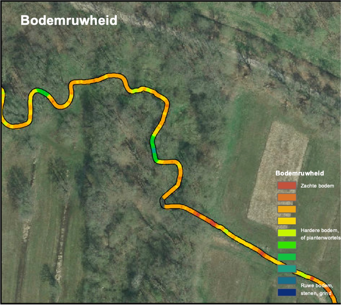
Monitoring is crucial here. Therefore, Medusa Explorations efficiently mapped the condition of the stream using sensors. All information was measured both before and after nourishment. In 2024, we conducted these measurements again to properly monitor the intervention. The results are very promising: many of the physical properties of the stream have remained virtually unchanged. Inspection of the stream also shows a lot of variation: some parts are already overgrown with aquatic plants and holding silt again, and there are deep and shallow sections in roughly the same locations. Ecological research has yet to reveal what effect this intervention will have on the ecology of the brook.
This project is an example of how efficient measurement techniques can be used to measure the effects of stream restoration. This approach has given us a complete picture of the structure of the stream, and with this knowledge, effective measures can now be taken in other streams.
Want to know more about landscape reconstruction in the Drentsche Aa? Read more here!